
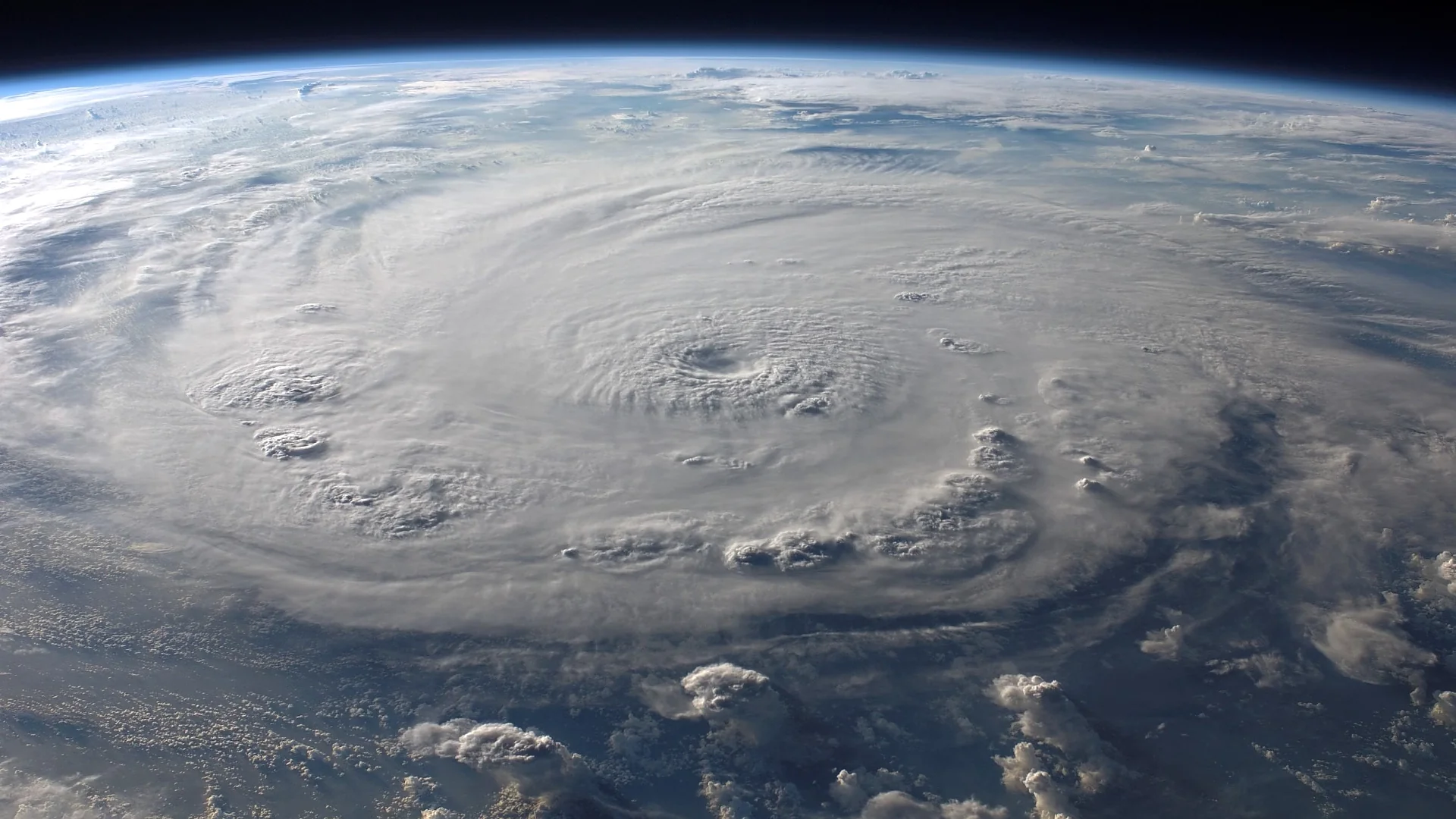
A tropical cyclone with a tilted circulation usually cannot intensify much until its lower and middle levels line up vertically. A new analysis of nearly three decades of airborne radar data has identified the structural and environmental conditions that separate storms whose tilted circulations quickly straighten from those that stay leaning, giving forecasters an earlier read on which weak systems are likely to strengthen.
TC-RADAR's 28 Years of Doppler Scans Separate Two Storm Fates
The researchers drew on the Tropical Cyclone Radar Archive of Doppler Analyses with Recentering, or TC-RADAR, an airborne Doppler radar database built by lead author Michael S. Fischer and colleagues. The archive contains 1,510 radar analyses collected by NOAA Hurricane Hunter aircraft across 28 hurricane seasons, from 1997 through 2024. Because the aircraft scan storms much like a medical CT scanner, the resulting three-dimensional wind and rainfall fields let researchers see how a cyclone's circulation shifts with height, something satellite imagery alone cannot resolve.
The team isolated weak tropical cyclones, systems below hurricane strength whose lower and middle circulation centers were already offset, then tracked each storm over the following day. Systems whose centers came back into vertical alignment within that window were classified as Quickly Aligning; systems that remained offset were classified as Persistently Tilted. Comparing the two groups revealed the atmospheric and oceanic conditions most closely associated with successful alignment. The study, titled "To Align or Not to Align? That Is the Question," appeared 17 July 2026 in the Journal of Geophysical Research: Atmospheres and was supported by a National Science Foundation award.
That framing matters because vertical alignment is widely treated, in prior tropical cyclone research, as a necessary step before a weak storm can intensify substantially. A tilted vortex is common in storms below hurricane strength, while storms that reach hurricane intensity are typically aligned. What has been harder to pin down is which tilted storms are about to straighten out and which will stay disorganized. This study is the first to compare the two outcomes directly using decades of radar observations rather than case studies or models alone.
A Tighter, Stronger Low-Level Circulation Marks the Difference
The clearest structural signal sits at the surface. NOAA's public summary of the findings describes Quickly Aligning storms as having a well-defined, tightly organized circulation near the sea surface, while storms that remain tilted tend to show a broader, weaker circulation that struggles to organize into a vertically stacked system. The paper's radar analysis backs this up: Quickly Aligning tropical cyclones have stronger and more compact lower-tropospheric circulations than their Persistently Tilted counterparts.
Tilt direction turns out to matter as much as tilt magnitude. The two groups start out with similar initial tilt; the horizontal offset between the low- and mid-level circulation centers isn't what decides the outcome on its own. What differs is orientation relative to the surrounding vertical wind shear, the change in wind speed and direction with height that can push a storm's circulation apart. Quickly Aligning storms tend to have their tilt oriented more cyclonically downwind of the shear vector, a position less exposed to further disruption. Persistently Tilted storms are more often oriented in a way that leaves them vulnerable to continued shearing.
The diagram below summarizes how the two storm types diverge, from a similarly tilted starting point toward two different structural and environmental profiles.
Ascent Near the Low-Level Center Does More Than Signal Organization
Beyond structure, the study found real differences in vertical motion. Quickly Aligning storms show more frequent and stronger ascent in the lower troposphere than Persistently Tilted storms, both near the low-level center and beneath the displaced mid-level vortex; differences higher in the storm were less pronounced. The authors describe convection as generally favored near a tropical cyclone's mid-level center, but they single out the lower-tropospheric mass flux within roughly 35 to 50 kilometers of the low-level center as the key driver of realignment, acting through vortex stretching and precession, the process by which concentrated upward motion near the circulation axis draws the tilted vortex back into vertical alignment.
Environmental conditions reinforced the structural picture. Quickly Aligning tropical cyclones formed in weaker mid-tropospheric vertical wind shear, with greater column-integrated precipitable water in the region surrounding the low-level center, and in environments with a higher maximum potential intensity, a theoretical ceiling on how strong a storm could become given the surrounding ocean and atmosphere, than Persistently Tilted storms.
Fischer, an assistant professor at the University of Miami's Rosenstiel School and the scientist who built the TC-RADAR database, put the underlying physics simply: "A tropical cyclone has to stand up straight before it can intensify." Co-author George "Trey" Alvey of NOAA's Atlantic Oceanographic and Meteorological Laboratory framed the forecasting stakes: "We are no longer just reacting to rapid intensification, we are anticipating it."
Because low-level wind strength, storm size, thunderstorm coverage, and tilt direction are all quantities Hurricane Hunter aircraft already measure during routine reconnaissance, the authors note that these signals could feed directly into operational forecasts, and could also be used to check whether high-resolution hurricane models reproduce the alignment process correctly.
What the Composite Comparison Can't Yet Prove
The comparison is a statistical composite built from past storms, not a physical simulation of any single cyclone, and the authors treat the stretching-and-precession explanation as a hypothesis rather than a demonstrated mechanism. Establishing that enhanced lower-tropospheric ascent actually causes realignment, rather than simply accompanying it, would require targeted case studies or numerical modeling that the current dataset cannot provide on its own.
The sample is also bounded by what Hurricane Hunter aircraft can reach. TC-RADAR draws mainly on missions flown over the Atlantic, Caribbean, and Gulf of America, so the findings describe storms in that basin and may not transfer directly to tropical cyclones elsewhere, where reconnaissance flights are rarer. Because the study focused specifically on weak, already-tilted systems, it also says less about storms that never develop a tilt in the first place or about the later stages of an already-aligned hurricane's intensification.
Translating the four signals into operational forecasts is still ahead of the research, not behind it. The paper's authors describe the next step as evaluating whether high-resolution hurricane models reproduce the alignment process the radar data shows, a test that has not yet been carried out. Until that evaluation happens, the findings work as a diagnostic checklist for forecasters and modelers rather than a forecasting tool in their own right.
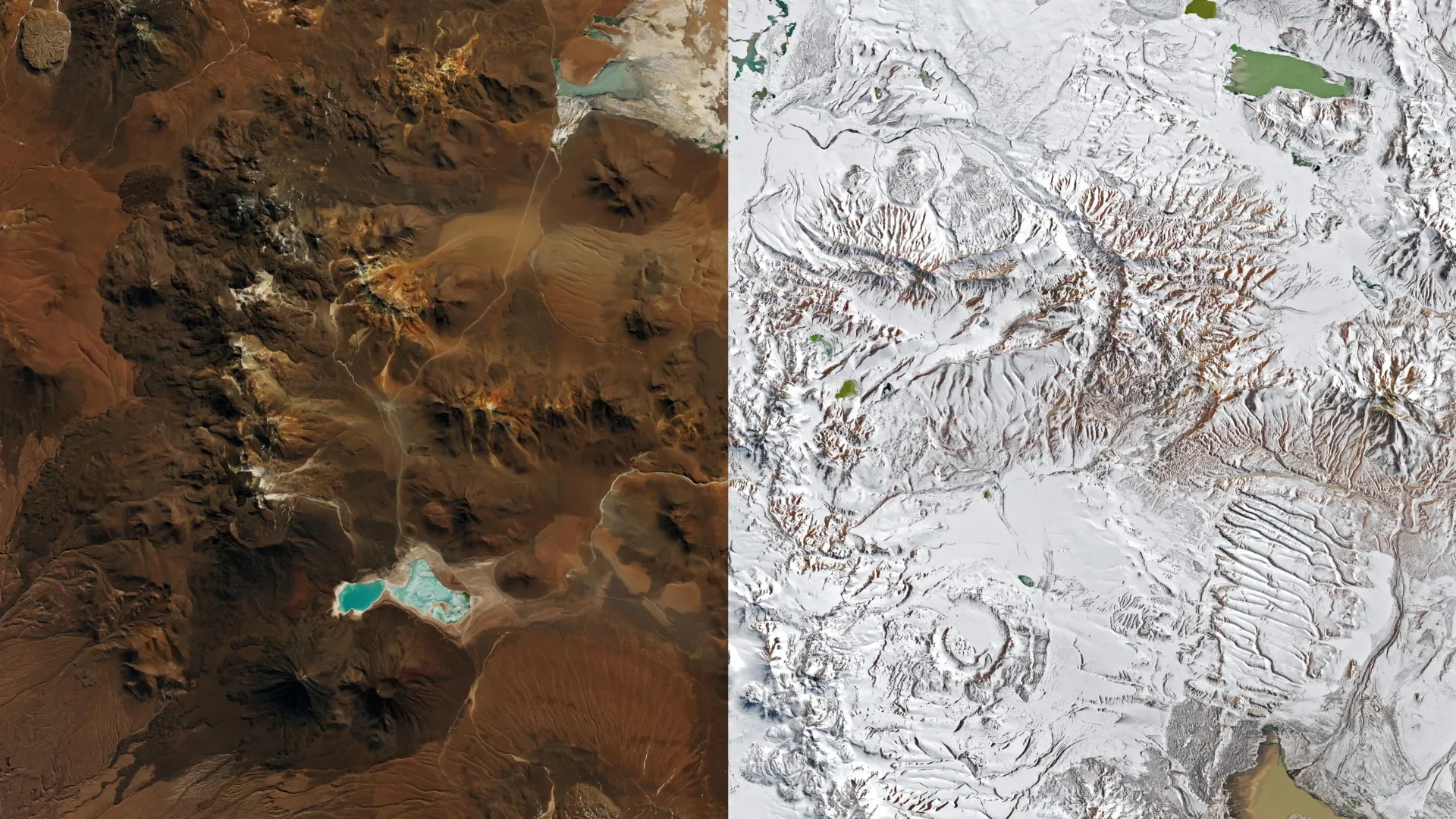
Storms Bury the Atacama Desert in Snow, Dump Ten Times Normal Rain on the Coast
Back-to-back storms buried Chile's Atacama Desert in snow, halted the ALMA telescope, and dumped 10x normal rain on Taltal amid a strengthening El Niño.

Ship Data Show Iodine and Sulfur Chemistry Seeding Arctic Clouds
A five-week Greenland ship campaign found iodine and sulfur acids seeding Arctic particles, then organic vapors grew them into far more cloud-seeding nuclei.
Comments (0)
Please sign in to join the discussion.
No comments yet.
Be the first to share your perspective on this topic.